

Hurricane Ian is now leaving the state of Florida after 12 foot storm surge caused Category 4 devastation to the Ft. Myers area and across the state.
As of the 11 a.m. National Hurricane Center postings, Ian is expected to arrive near Myrtle Beach, South Carolina beginning Friday as a Category 1 Hurricane.
Charleston, S.C. is currently projected in the center of most models. Ian is expected to bring 75 mile per hour sustained winds.
Myrtle Beach is now projected to be on the North Eastern quadrant of the model. The strongest winds are found on this quadrant.
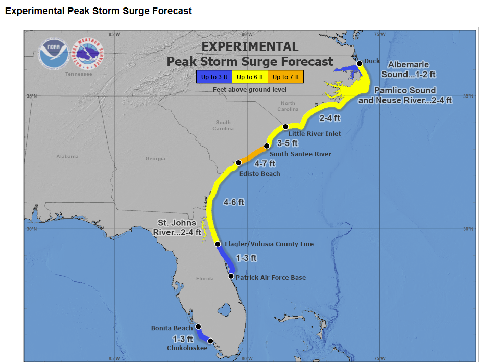
As a Category 1, residents should concern themselves with heavy rains and storm surge from Ian.
3 Foot to 5 Foot Storm Surge Projected
PROJECTED RAINFALL
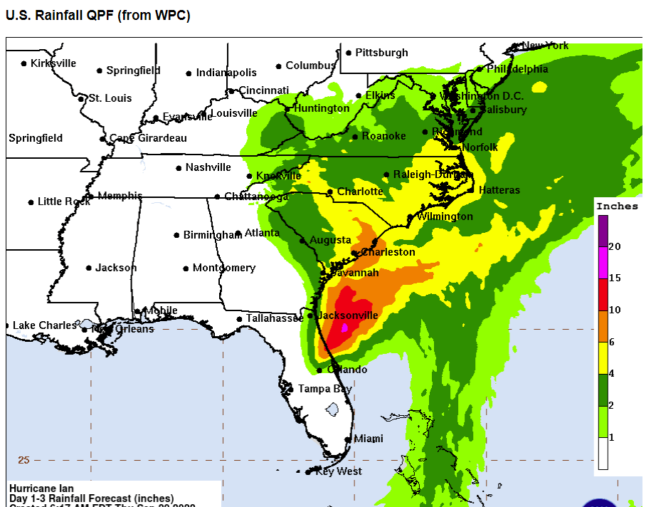
Horry County is currently projected to get 6 inches of rainfall over a very compact 12 hours.