

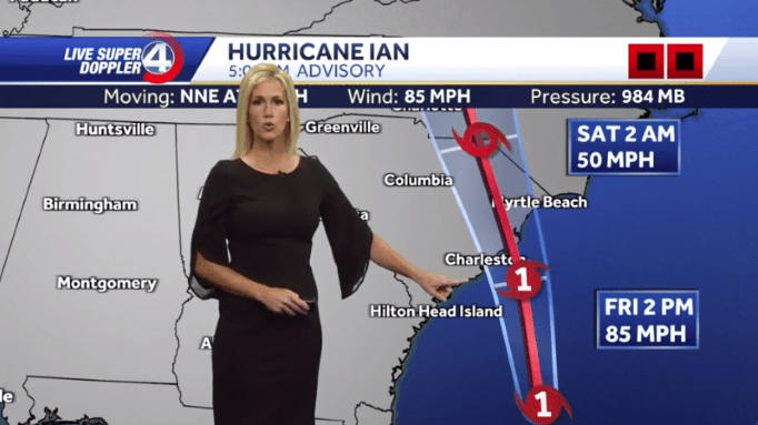
The 5 a.m. National Hurricane Center update has the eye of Ian arriving just south of Myrtle Beach.
Ian is a category 1 hurricane with sustained winds at 85 miles per hour.
The Northeast side of any Atlantic coast hurricane is the worst possible location for any town or city. The hurricane spins counter clock wise, meaning the strongest winds and highest storm surge can be expected on the northeast side.
6 foot to 8 foot storm surge is possible for our area.
As an example, Ft. Myers experienced 12 foot storm surge. Storm surge and rain from Hurricane Ian should be the principle concern for area residents.
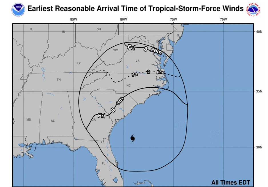
The outer bands of the hurricane are already being felt onshore. The storm is expected to arrive between noon and 2 p.m. today.