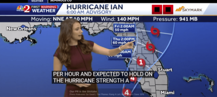
Sept. 28 Update: As of 7 a.m. today, Ian is listed as a major Category 4 Hurricane. It is now projected to come into the Ft. Myers area at around 2 p.m. today. It will then head Northwest across the state heading back into the Atlantic Ocean as a tropical storm. The storm is then projected to take a northeastern path coming back on shore near the Georgia/S.C. Coast.
Horry County can expect huge rains from Ian starting Friday, September 30th. Areas that have a history of local flooding, including Socastee S.C. and Longs S.C. should prepare in advance.
The National Hurricane Center has issued a warning for residents living in the Fort Myers to Tampa Bay regions of Florida.
Hurricane-force winds are possible beginning Wednesday morning with tropical storm conditions possible by late tomorrow p.m. for areas that run from Ft. Myers to Cedar Keys Florida.
Hurricane Ian is massively wide. Areas in Horry County that include Longs, S.C. and Socastee S.C. should prepare in advance for heavy rains and flood-like opportunities.
These rains are forecasted to arrive in S.C. beginning Friday, September 30th.


